 Distance
 Elevation
 Observed Wildlife
The Mount Tripyramid hike has three distinct personalities: flat wide dirt road, dramatic steep slides, and boreal forest. The climb up and down the slides are heart-pumping and provide amazing views. The three summits burried in the boreal forest help calm the nerves. Ground is covered quickly through the pretty Livermore Road.


This hike marked the end of an amazing summer of hiking in 2020. I discovered summer in the Whites can be a fairly confusing affair. All the trees at the trailhead had all their leaves. However some had a touch of color and air was a hair above freezing. Once I paid the $5 park fee and strapped up my pack, I was on the move trying to get my heart pumping and body temperature up.


I had a tough time warming up since Livermore Road is flat and wide. It did still hold the beauty of the White Mountains. The road continued in this fashion for three and a half miles as it gradually became more steep. At one point a jogging hiker passed me trying to get his core temp up. I decided to follow suit and caught up to the other hiker. We ended up sharing the trail for the remainder of the climb. His name is also Rob and I deemed the experience “Two Robs in the Woods.”


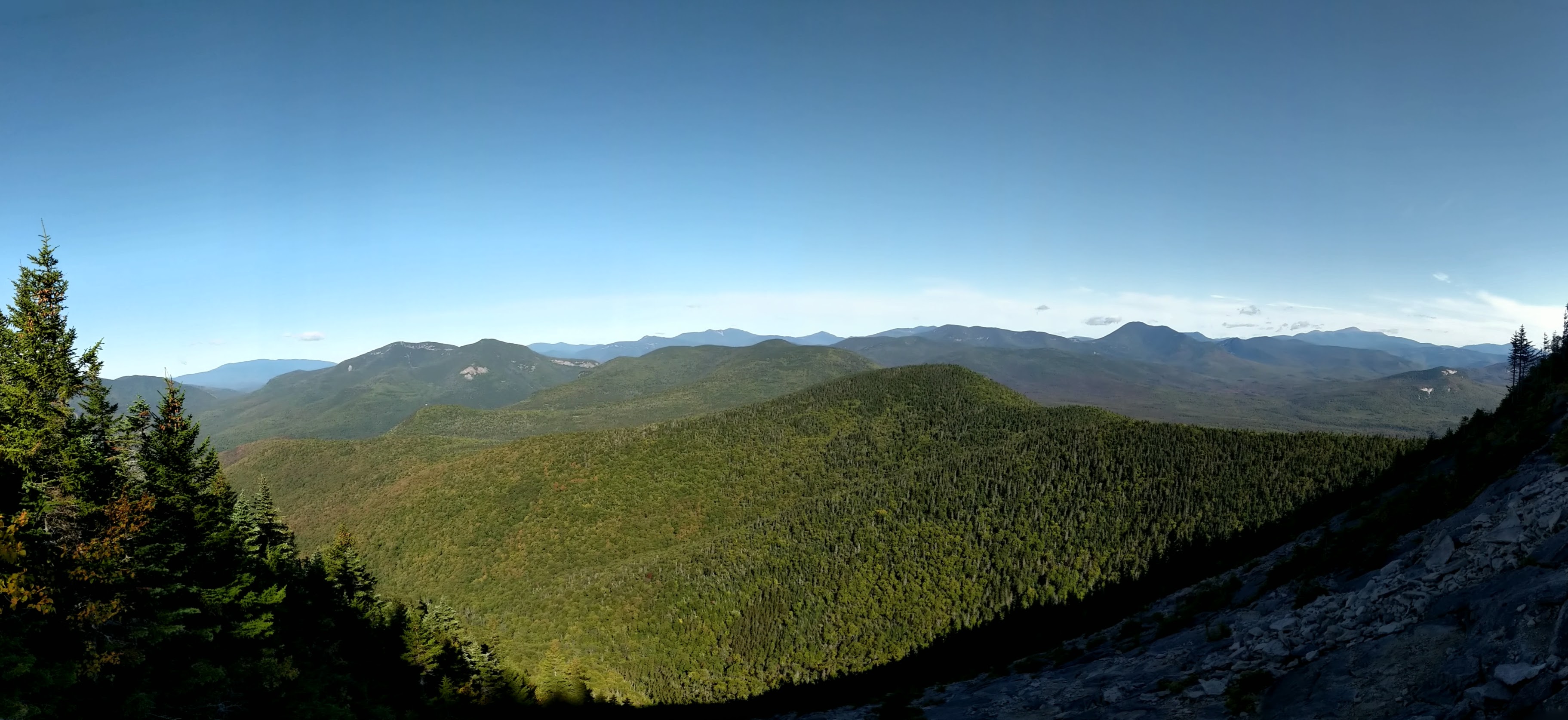
After an hour of fast walking, we reached Mt Tripyramid Trail and the gravel road changed to a narrow path. The classic White Mountain trail immediately crossed Avalanche Brook, the grade slightly steepened and continued for a half mile. Then the footing transitioned from soil to exposed rock and the trees started to open to signify the start of the north slide. It was an entirely new hiking experience for me. The next half mile climbed twelve hundred feet at a completely consistent grade following the slope of the exposed bedrock. The other Rob and I continued moving efficiently using our hands to grip roots and rock holds. The climb’s difficulty was matched only by how gorgeous the hike became as the vista of the slide opened. I frequently stopped to catch my breath and take in the view. The Osceolas showed themselves first, followed by Tecumseh and its ski trails, Franconia Ridge, Mount Carrigain, and eventually the Presidentials through the cool dry air.


A few tips I wish I would have given myself in the moment: sit and eat a snack at the first opening (you just climbed a thousand feet and hiked four miles and your body needs it); put on some gloves so your fingers don’t fall off (the rocks you keep grabbing are as cold as the air); put on a long sleeve layer (it’s now windy at this elevation and exposure), relax and enjoy the views (they are the best of the day and the reason you climb these damned mountains), and, most importantly, DO NOT TRY TO KEEP UP WITH THE OTHER ROB (he just told you he hiked the entire Long Trail in less than three weeks with a broken foot, he has a smaller pack than you, and he’s climbed most of the four thousand footers twice).

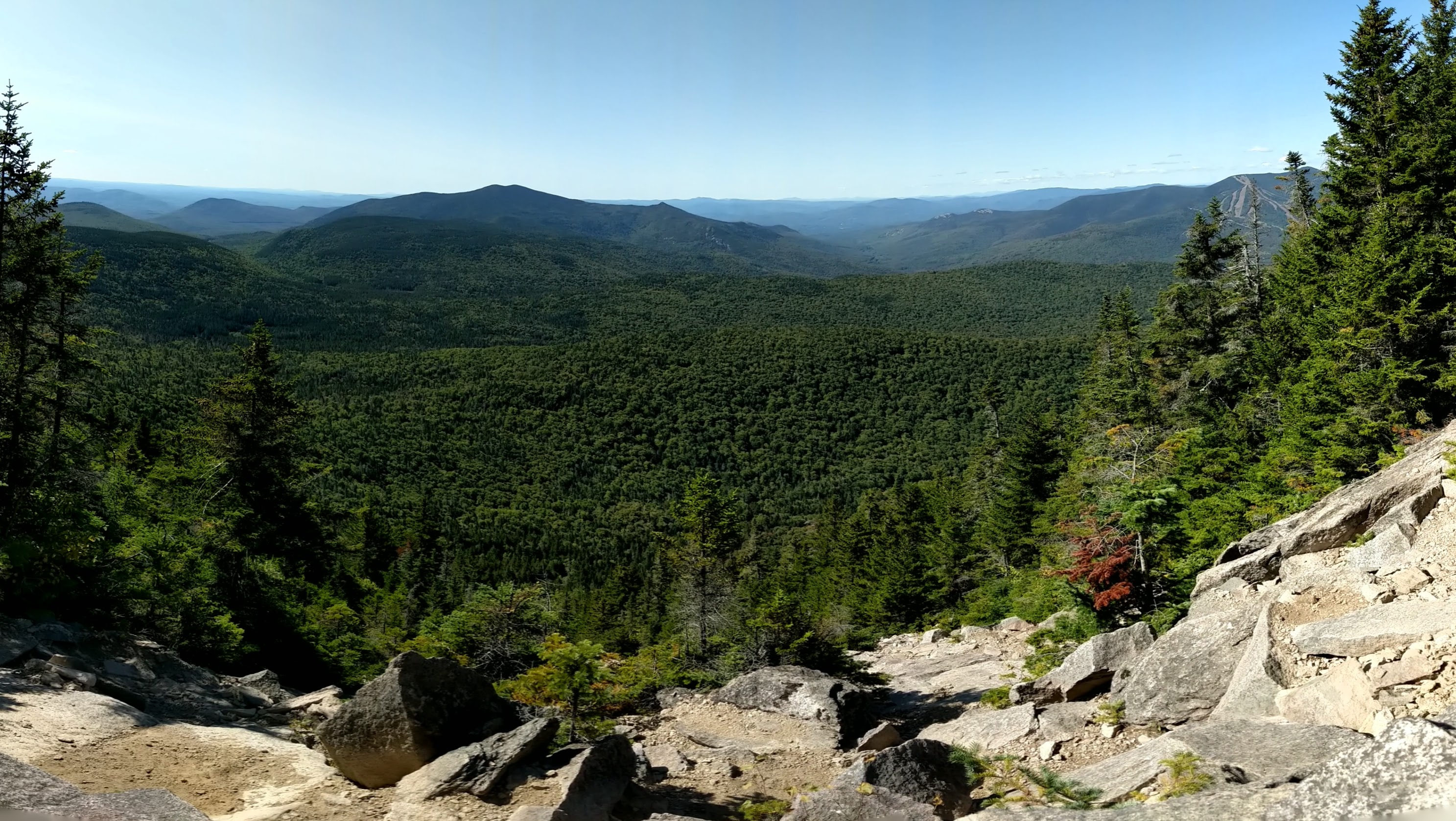
The excitement quelled when I reentered the woods a few dozen feet before reaching North Tripyramid. The peak is viewless but I loved walking on the much more level terrain of the enclosing boreal forest. A bit over twenty minutes later, I reached Middle Tripyramid and bid adieu to my fellow Rob, as I was well overdue for a rest. An east-facing view looking straight out at Tecumseh greeted me just before I came upon a west-facing view pointing directly at Passaconaway with Chocorua behind. These views could only be enjoyed while standing (the accompanying pictures are with my camera raised at full stretch above my head).


By this time I had realized that I didn’t feel quite right. The combination of cold and a lack of calories had me feeling a bit off. Also my hands needed warming and I noticed my right hand was inflamed. I put on all my layers, my hat, and my gloves and downed some pepperoni, triscuits and a clementine. When I’m in the woods I like to take my breaks with some scenery. I quickly got restless looking without a view and continued to the south peak and the open south slide.

I moved at a more leisurely pace and reached the south peak twenty five minutes later. A few minutes later, I reached the south slide. I found the first flat rock available and out of the way, and set up for lunch. I devoured my Sandwich Range sandwich while looking out at Sandwich Dome (Too much sandwich? I think not).
The south slide was much less open, dramatic, and stable than the north slide. The footing was loose and I took my time descending the steep terrain. I kept my gloves on as long as I could, not only for warmth, but for protection in case of a stumble. Of course, I ended up after removing my gloves, but was fortunate to fall straight back on my pack while scraping up my wrist a bit.


After a half hour of descending I made it off the slide and back onto the firm ground of the mixed forest. The grade remained steep, but the ground had changed from gravel to soil so I tested my foot speed with intermittent exhilarating trail runs. Less than twenty minutes later I stopped when the trail crossed an unnamed brook that immediately flowed into Slide Brook. I spotted a big tree fallen over Slide Brook that was resting at least ten feet above the brook. I easily walked on the broad trunk and took a seat amid the serene forest. I am grateful for every moment like this in the woods and marked it with a waypoint on my All Trails map. It should be years before the tree decays and I encourage any reader following this route to plan a stop here.
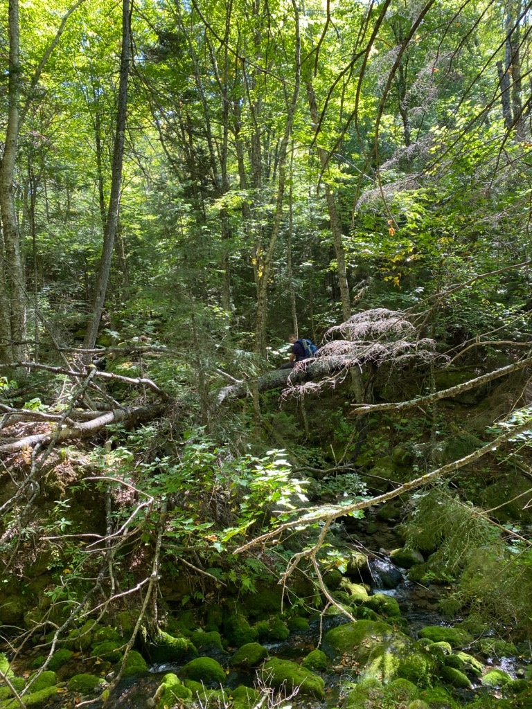
I returned to the trail and resumed my fast pace until I reached a party of three. One of the gentlemen snapped a picture of me on the tree and was friendly enough to share it with me (above photo credit to Ralph Davino). The trail then returned to comfortable Livermore Road. I shared the trail and a conversation about some of our favorite hikes with my fellow outdoorsman. We parted after reaching Norway Rapids where we took a very short detour to walk on the interesting geology of the stream.

The trail continued to level out as I absorbed the fleeting sights of summer and mountain bikers cruising past. Someday I should return to this part of Waterville Valley on a bike or some cross country skis. I arrived at the trailhead at 1:25 and concluded my fourth visit of the year to the Sandwich Range Wilderness.


